Bitmap vs Svg
Click or tap the map to enlarge it.
Key Takeaways:
- Bitmap and SVG are two different types of image formats used in cartography.
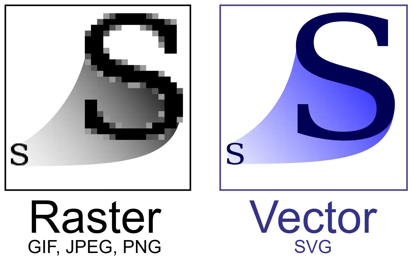
- Bitmap images are made up of pixels, while SVG images are based on vector graphics.
- Bitmap images are commonly used for photographs and complex visuals, while SVG images are ideal for maps and simpler illustrations.
- SVG images are scalable without losing quality, making them perfect for digital and interactive maps.
- Both formats have their advantages and disadvantages, and the choice depends on the specific requirements of the map design.
History: A Brief Overview of Bitmap and SVG Maps
In the world of cartography, maps have evolved significantly in terms of technology and design. One of the key areas of distinction between maps is the image format used, particularly Bitmap and SVG.
Bitmap Maps:
Bitmap images, also known as raster images, are made up of a grid of pixels, where each pixel contains color information. These images are resolution-dependent, meaning their quality can decrease when magnified. The earliest bitmap maps were hand-drawn before computers and digital tools became the norm in mapmaking.
The advent of digital mapping led to the use of bitmap images in cartography, primarily due to their ability to represent complex visuals such as aerial photographs and satellite imagery. Bitmap maps are widely used in online mapping platforms, navigation systems, and smartphone map applications.
SVG Maps:
SVG, short for Scalable Vector Graphics, is a format based on XML that uses mathematical equations to represent images. Unlike bitmap images, SVG maps are resolution-independent, meaning they can be scaled to any size without loss of quality. This scalability is ideal for modern digital and interactive maps.
With SVG maps, cartographers can create smooth lines, sharp edges, and precise shapes that remain visually appealing at any zoom level. They are especially advantageous for maps displayed on high-resolution devices, providing a more detailed and immersive experience.
Unique Insights: Pros and Cons of Bitmap and SVG for Maps
Bitmap Maps:
- Pros:
- Highly versatile in terms of representing complex visuals and photographic images.
- Can be edited in various image editing software for retouching and adjusting colors.
- Widely supported and compatible with most devices and software.
- Cons:
- Bitmap images are resolution-dependent, so they may lose quality when scaled up.
- Large file sizes can slow down loading times, especially on slower internet connections.
- Difficult to work with when it comes to editing individual components of the map.
SVG Maps:
- Pros:
- Scalable without any loss in quality, making them perfect for digital and interactive maps.
- Smaller file sizes compared to bitmap images, resulting in faster loading times.
- Elements of the map can be easily manipulated and edited, allowing for greater flexibility.
- Cons:
- May not be suitable for highly complex visuals such as aerial photographs.
- May require more computational resources when rendering complex SVG maps.
- Compatibility issues may arise with older devices or software.
Relevant Facts: A Table of Events in Cartography History
| Year | Event |
|---|---|
| 5th century BCE | Ancient Greeks create the earliest known maps. |
| 11th century | Arab cartographer, Al-Idrisi, creates a detailed world map for King Roger II of Sicily. |
| 16th century | Gerardus Mercator introduces the Mercator projection, revolutionizing world maps. |
| 19th century | Advancements in lithography allow for the mass production of maps. |
| 20th century | Digitization of maps begins, leading to the development of digital cartography. |
Frequently Asked Questions
-
What are the main differences between bitmap and SVG maps?
Bitmap maps are made up of pixels and are resolution-dependent, while SVG maps are based on mathematical equations and are resolution-independent. Bitmap maps are great for complex visuals, while SVG maps excel in scalability and flexibility.
-
Which format is better for digital and interactive maps?
SVG maps are better suited for digital and interactive maps as they can be scaled to any size without losing quality, resulting in a smoother user experience. Bitmap maps may lose quality when scaled up, affecting the overall visual appeal.
-
Are there any specific scenarios where bitmap maps are preferred?
Bitmap maps are preferred in scenarios where complex visuals such as aerial photographs and satellite imagery need to be accurately represented. They are commonly used in online mapping platforms, navigation systems, and smartphone map applications.
-
Do SVG maps have any limitations?
While SVG maps have many advantages, they may not be suitable for highly complex visuals like aerial photographs. Additionally, rendering complex SVG maps may require more computational resources compared to bitmap maps.
-
Can bitmap and SVG maps be converted from one format to another?
Yes, it is possible to convert bitmap maps to SVG format using specialized software. However, the conversion process may not always yield perfect results, and certain details or features of the original map can be lost or distorted.
-
Which format is widely supported and compatible?
Both formats are widely supported and compatible with most devices and software. However, bitmap images have been in use for a longer period and therefore enjoy broader universal support.
-
What does the future hold for bitmap and SVG maps?
As technology and computing power advance, SVG maps are expected to become more prevalent due to their superior scalability and flexibility. However, bitmap maps will continue to find their place in specialized applications that require complex visuals and detailed representations.