Argentina Location Map
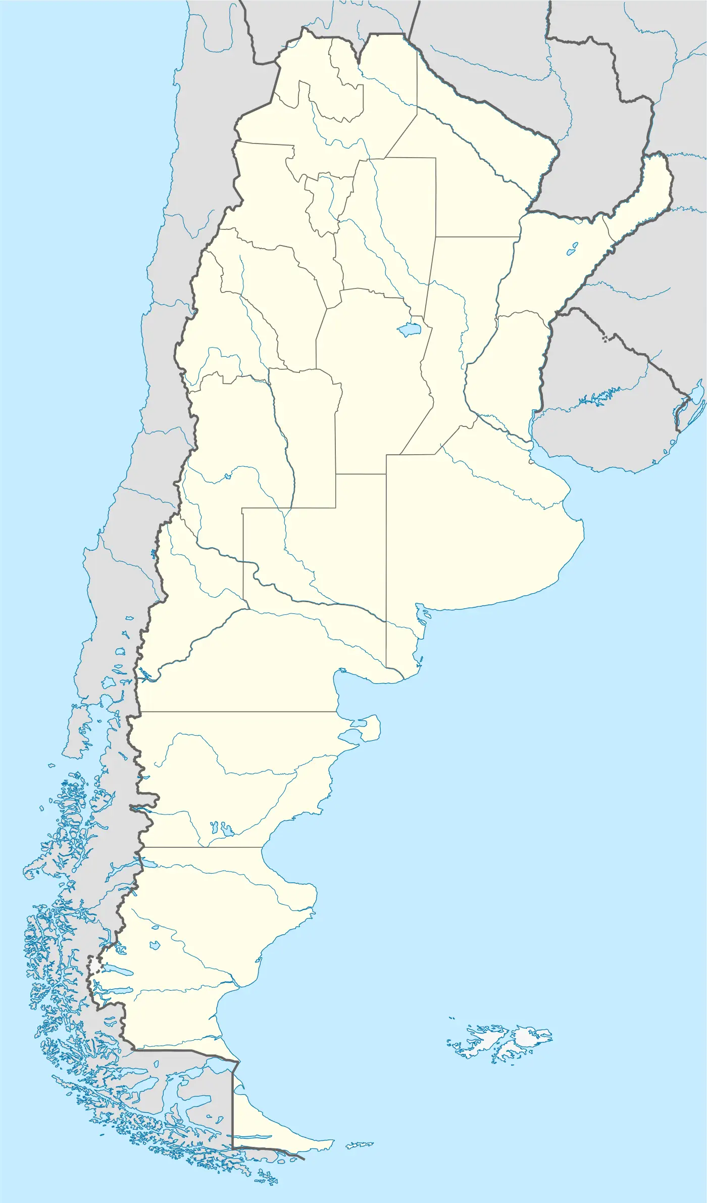
Click or tap the map to enlarge it.
Key Takeaways
- Argentina Location Map – A comprehensive guide to the geographical position of Argentina.
- Explore the South American country from a cartographic perspective.
- Discover the diverse landscapes and features that make Argentina a unique destination.
- Learn about the historical significance of Argentina’s location in relation to global trade and exploration.
- Uncover interesting facts about Argentina’s geography, climate, and neighboring countries.
History
The Argentina Location Map showcases the position of Argentina, a South American country situated in the Southern Hemisphere. The map highlights Argentina’s geographical location and its relationship to the surrounding countries and bodies of water.
Argentina, officially known as the Argentine Republic, has a rich history dating back to ancient times. The indigenous people, including the Mapuche, Tehuelche, and Guarani tribes, inhabited the region long before the arrival of European explorers.
The European exploration of Argentina began in the 16th century when Spanish navigators, led by Juan Díaz de Solís, arrived in the area. The Spanish colonization of Argentina commenced in the 16th century, and over the years, the region witnessed significant political, social, and economic changes.
Argentina gained independence from Spain in 1816, marking a turning point in its history. The country witnessed periods of growth, turmoil, and immense immigration, shaping its culture and identity.
Unique Insights
The Argentina Location Map provides several unique insights into the country’s geography:
- Argentina is the second-largest country in South America, covering an area of approximately 2.8 million square kilometers.
- The western border of Argentina is formed by the majestic Andes mountain range, offering breathtaking natural landscapes.
- The country is home to the world-famous Patagonia region, known for its diverse wildlife, glaciers, and stunning landscapes.
- Argentina boasts remarkable geological features, including the Iguazu Falls, the highest waterfall system in the world.
- The pampas, expansive fertile plains, dominate the central region of Argentina, making it ideal for agricultural activities.
- Argentina shares borders with several countries, including Chile, Bolivia, Paraguay, Brazil, and Uruguay.
- The coastline of Argentina stretches along the South Atlantic Ocean, offering picturesque beaches and wildlife-rich areas.
Table of Relevant Facts
| Year | Event |
|---|---|
| 1516 | Juan Díaz de Solís explores the Río de la Plata area. |
| 1816 | Argentina gains independence from Spain. |
| 1880 | Buenos Aires becomes the capital of Argentina. |
| 1930-1943 | Period of political instability in Argentina. |
| 1982 | Falklands War between Argentina and the United Kingdom. |
| 1993 | Constitutional reforms lead to the establishment of a federal system. |
| 2013 | Jorge Mario Bergoglio becomes the first Pope from Argentina. |
FAQ
-
Where is Argentina located?
Argentina is located in the southern part of South America, bordered by Chile to the west and the South Atlantic Ocean to the east.
-
What is the size of Argentina?
Argentina is the second-largest country in South America, covering an area of approximately 2.8 million square kilometers.
-
What are some famous landmarks in Argentina?
Argentina is home to various famous landmarks including the Iguazu Falls, Perito Moreno Glacier, Mount Aconcagua, and the Andes mountain range.
-
Which countries share a border with Argentina?
Argentina shares borders with Chile, Bolivia, Paraguay, Brazil, and Uruguay.
-
What is the climate like in Argentina?
Argentina experiences diverse climate zones due to its vast territory. The climate ranges from subtropical in the north to subpolar in the southern regions, including the famous Patagonia.
-
What is the significance of the pampas in Argentina?
The pampas are expansive fertile plains, covering the central area of Argentina. They are vital for agricultural activities, including the growth of crops and cattle farming.
-
What is the official language of Argentina?
The official language of Argentina is Spanish.