Blank Map Rajasthan State and Districts
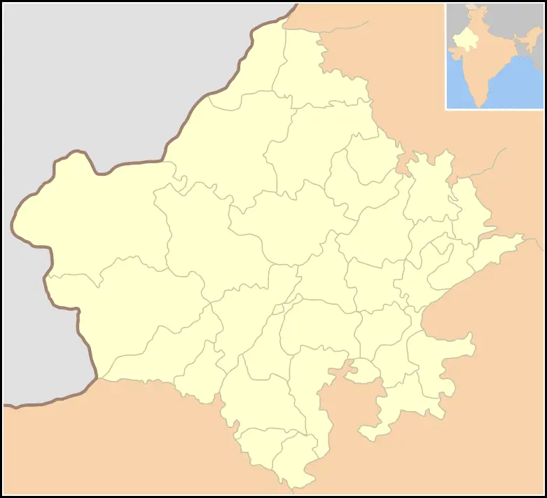
Click or tap the map to enlarge it.
Key Takeaways
- Rajasthan is a state located in northern India.
- It is known for its rich cultural heritage, vibrant festivals, and majestic palaces.
- The Blank Map of Rajasthan State and Districts provides a comprehensive overview of the geographical layout of
the region. - It is useful for educational purposes, research, and planning.
- The map showcases the boundaries of Rajasthan’s districts, providing valuable information for travelers,
historians, and geographers. - By studying this map, one can gain a deeper understanding of Rajasthan’s administrative divisions and their
spatial arrangement.
History
The history of Rajasthan is intricately linked with its geography. The Blank Map of Rajasthan State and Districts
allows us to explore the historical significance of various regions within the state.
Rajasthan, meaning “Land of Kings,” has a rich past that dates back thousands of years. It was once a crucial part
of the Indus Valley Civilization and witnessed the rise and fall of various dynasties.
From the ancient Maurya and Gupta empires to the Rajput kingdoms and the Mughal era, Rajasthan has been witness to
significant historical events.
With the Blank Map of Rajasthan State and Districts, one can trace the footsteps of conquerors, marvel at the
architectural wonders they left behind, and understand how the region evolved over time.
Unique Insights
The Blank Map of Rajasthan State and Districts offers some unique insights:
- Rajasthan is divided into 33 districts, each with its unique characteristics and cultural heritage.
- Jaipur, the capital of Rajasthan, is one of the most prominent cities on the map and boasts historical landmarks
like the Amer Fort and the City Palace. - The Thar Desert, also known as the Great Indian Desert, dominates a significant portion of the map. It is the
world’s 17th largest desert. - Rajasthan is known for its impressive hill forts, including the UNESCO World Heritage Sites of Chittorgarh,
Kumbhalgarh, and Jaisalmer. - The Aravali Range runs across Rajasthan, adding to its diverse topography.
- The Ranthambore National Park, located in the Sawai Madhopur District, is one of the largest national parks in
northern India.
Table of Relevant Facts
| Year | Event |
|---|---|
| 1949 | Rajasthan became a separate state within India. |
| 1956 | The boundaries of Rajasthan were redrawn to include new districts. |
| 2000 | Three new districts were created: Dholpur, Karauli, and Sawai Madhopur. |
| Present | Rajasthan is known for its thriving tourism industry, attracting visitors from all over the world. |
Frequently Asked Questions (FAQ)
1. Why is the Blank Map of Rajasthan State and Districts useful?
The map provides a visual representation of Rajasthan’s districts, which helps in understanding the spatial
arrangement and administrative divisions of the state.
2. How can the map be used for educational purposes?
Teachers and students can utilize the map to learn about the geography, history, and culture of Rajasthan.
Additionally, it can aid in conducting research and preparing presentations.
3. What is the importance of studying Rajasthan’s districts?
Studying the districts helps in understanding the regional variations, cultural diversity, and economic
development within Rajasthan.
4. Can the map be used for planning travel within Rajasthan?
Absolutely! The map can assist in planning itineraries and identifying popular tourist destinations within the
state.
5. Are there any maps available specifically for individual districts in Rajasthan?
Yes, there are maps available that provide a more detailed view of each district, highlighting towns, villages,
and landmarks.
6. How often are the district boundaries updated?
The district boundaries are periodically reviewed and updated as per administrative requirements and government
decisions.
7. Where can I find more information about Rajasthan’s historical monuments?
You can find more information about Rajasthan’s historical monuments in various books, travel guides, and online
resources dedicated to the region’s rich heritage.