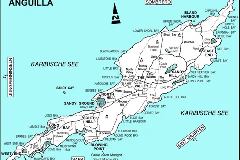
Flagmap of Anguilla
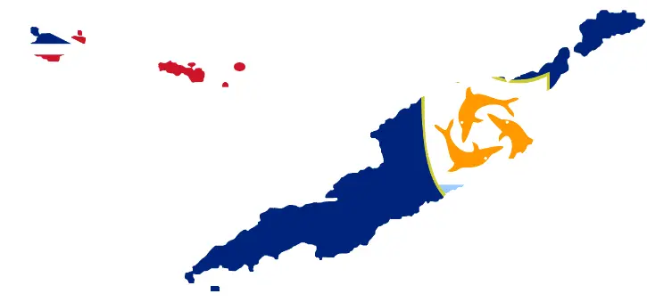
Click or tap the map to enlarge it.
Key Takeaways
- Anguilla is a British Overseas Territory located in the Caribbean Sea.
- The Flagmap of Anguilla incorporates the national flag into the outline of the country.
- It is used as a symbol of national pride and unity for the people of Anguilla.
- The design of the Flagmap is visually appealing and distinctive.
- It represents the unique identity and cultural heritage of the nation.
History
Anguilla is a small island nation in the Caribbean Sea with a rich history. The Flagmap of Anguilla is a representation of its national flag integrated into the shape of the country.
Anguilla was originally inhabited by the Arawak and Carib peoples, but it was later colonized by European powers. The island was first settled by the British in 1650 and remained under British control throughout most of its history.
In 1967, Anguilla briefly declared independence from the associated state of Saint Kitts and Nevis. This declaration led to a series of conflicts, which eventually resulted in the reestablishment of British control in 1971.
The Flagmap of Anguilla gained popularity as a symbol of national pride and unity following these events. It is a visual representation of the country’s struggle for self-determination and serves as a reminder of its unique identity.
Unique Insights
The Flagmap of Anguilla is a unique design that sets it apart from other national flags in the Caribbean. It combines the elements of the national flag with the outline of the country, creating a visually appealing and distinctive emblem.
By incorporating the national flag into the map, it showcases the importance of both the land and the people. It represents the unity and shared values of the inhabitants of Anguilla.
This innovative design has become a source of national pride for Anguillians, symbolizing their resilience and determination as a nation. It is a powerful representation of their history, culture, and aspirations.
Table of Relevant Facts
| Year | Event |
|---|---|
| 1650 | British settlement of Anguilla |
| 1967 | Anguilla briefly declares independence from Saint Kitts and Nevis |
| 1971 | British control reestablished in Anguilla |
Frequently Asked Questions (FAQ)
1. What is the Flagmap of Anguilla?
The Flagmap of Anguilla is a unique design that incorporates the national flag into the outline of the country.
2. Why is the Flagmap important to Anguillians?
The Flagmap is important to Anguillians as it represents their national pride, unity, and struggle for self-determination.
3. How did Anguilla gain independence from Saint Kitts and Nevis?
Anguilla briefly declared independence from Saint Kitts and Nevis in 1967, leading to conflicts that resulted in its reestablishment under British control in 1971.
4. What does the Flagmap symbolize?
The Flagmap symbolizes the unique identity, cultural heritage, and aspirations of the nation of Anguilla.
5. Is the Flagmap officially recognized?
While the Flagmap is not officially recognized as the national flag, it is widely embraced as a symbol of Anguillian pride.
6. How does the Flagmap differ from other national flags in the Caribbean?
The Flagmap stands out due to its creative integration of the flag into the shape of the country, creating a visually distinctive emblem.
7. Where can I see the Flagmap of Anguilla?
The Flagmap of Anguilla can be seen in various forms, including official documents, publications, and cultural events within the country.